LOS GLACIARES NATIONAL PARK
GENERAL INFORMATION
OF THE AREA
The protected area started being protected since 1937. In 1971, by means
of Law Nº 19.292, the current limits of the National Park and the
Natural Reserve were established.
The National
Park´s 724.000 hectares are ubicated in the southwest area of Santa
Cruz. The park belongs to the forest, patagonic steppe and Altos Andes
eco-regions.
NATURAL RESOURCES
Landscapes. Flora and fauna
Thousands of years ago, glaciers covered a big part of the national park.
These ice rivers eroded and gave shape to the landscape, excavating in
the mountains large valleys. At the same time these ice rivers were fragmenting
and dragging lot of rocks, which had been accumulated in the front and
the sides of the glacier, making small hills called “morrenas”.
In a later climate change, which included a temperature increase, caused
the reduction of the surface occupied by ice. Large milky water lakes
occupied the bottom of the valleys and lush forests covered their slopes.
The ice countryside occupied an approximate surface of 2.600 km2 (a 30
% of the surface is covered by ice). From there, 47 bigger glaciers descend.
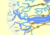
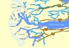
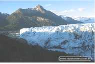
The most famous glacier is the Perito Moreno, which expands over the south
side of the Argentino Lake waters, with a 5 km front and 60 metres high
over the lake.
Upsala glacier, which is ubicated in the north side of the same lake,
is the bigger one, with 50 km length and almost 10 km wide.
in the north side of the PN Los Glaciares (Los Glaciares National Park) there is the Fitz Roy, which stands up for its length (3.375 metres) and its huge aspect: a surrounding “cordillerana” mountain chain environment.
The aridest environment of the park is the steppe. There plants that are adapted to dry situation and heavy winds compose the vegetation. The small and prickly trees and the rough leaf grass provide protection to the ground, avoiding its erosion. And also they help to feed the “guanaco” and the “choique”.
The decrease of rains in the east of the area changes the landscape. In the area, called "ecotono" typical forest species coexists with other characteristics of the steppe. Groups of “ñires” and “lengas” appear between “calafate” and “notro” brushes and coexists with brushes dominated by the “coiron”.
in the heights, over the 1100 metres above the sea, strong winds, low temperatures and snowstorms don't let vegetables grow. The few and small plants which grow in the ground were adapted to live in short periods because of the difficult climate conditions.
Forests, which composition also depends on the heights and the climate conditions, occupy slopes and low areas. However, predominant species belongs to the same group, the Nothofagus, represented in the PN by three types: the “lenga”, that can be found in the all area, the “ñire” and the “colihue” or “guindo”.
Mammals, difficult to be observed, like the “gato montés”, the “hurón” and the “huemul”, frequent the sub-antarctic's forest. This animal goes down to the low slopes in winter in order to find food and refuge.
Other mammals are easy to be found, like the “zorro colorado” and the “puma”. Also usually appears the “condor” and birds like the “agachonas” and the “yales”, as well as little rodents.
Many birds find food and refuge in the forests, like the “cotorras australes” or “cachañas” and the little “rayaditos”.
The “carpinteros patagónicos” can be identified by their “tamboreros”, made with their beaks over the trunks.
The rodents are prey of their main predators: the “lechuzas”.
The “pato de las torrentes” captures his food diving in the watercourses, also frequented by the “remolineras”.
in the grasslands, present in the small open areas, which count on small water areas, live “bandurrias”, “cauquenes”, different species of ducks and amphibian called “ranita de cuatro ojos”.
in the
east side of the Park, the Andes disappear in the patagonic tableland
and in the forest are replaced by the steppe. There live “guanacos”,
“zorros grises” and “zorros patagonicos”. Between
birds, the “ñandu petiso” is the most outstanding.
In 1981 the UNESCO has declared this place Humanity Worldwide Heritage
Place because of its spectacular beauty, its glaciological and geomorphologic
interest, and because many fauna species are in danger of extinction.
CLIMATE
The climate in the area is wet warm. The annual media temperature is 7.5º
C, and in winter the media is 0.6º C, whereas in summer is
13.4º C.
As long as we move away from the mountain chain the rains decrease. Such
a different kind of ambient appears because of the relief and the variations
of the climate.
ACCESS
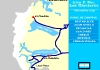
Leaving from Rio Gallegos city visitors have to take Provincial Route
Nº 5 and National Route Nº 40. Going along Provincial Route
Nº 11 visitors get to El Calafate city, 50 km away from the National
Park. Between Rio Gallegos and El Calafate there is a distance of 316
km. From El Calafate people arrive to El Chalten, a locality situated
in the north part of the protected area, taking Provincial Route Nº
11, National Route Nº 40 and finally Provincial Route Nº 23.
There are many land transports from different parts of the country. By
plane, visitors can get to El Calafate International Airport.
CULTURAL RESOURCES
3.000 years ago the Argentino Lake region was occupied by groups of hunters-recollectors,
with a high mobility in order to take advantage of the places situated
in the steppe and in the forest which are in different heights (from 200
to 1.000 metres above the sea). The economy, centralise in “guanaco”
exploitation, used to be based in the complementary utilization of different
ambient which exits in different moments of the year.
The old inhabitants used rock to make their arms and instruments, and
used the refuge that offered the projecting rocks or eaves. Most of these
men left paints, as a mark of their presence. An example pf that can be
found in the Roca Lake zone, where a projecting shows abstract leitmotif
like lines, points, curve lines and figures that represents men and animals.
The investigations of the archaeological places had detected many materials
from the Pacific Ocean that shows the direct access to that places and
the existence of exchange networks.
Cultural
heritage
Law protects archaeological and paleontological places. The destruction
or extraction of our cultural heritage is a crime and alters long periods
of our history.
SUGGESTIONS
Remember that you are visiting a protected area, so it is recommended
to respect established rules for a better conservation of the region.
If you visit the national Park by car, remember that access roads are
not paving.Drive carefully, slow and with the car lights on along the
path. Use seatbelt.It is recommended to have two spare tire and extra
fuel.In winter visitors should obtain information about how passable are
the routes, use tyres covered by chains or nails, and carry extra warm
clothes, hot water, food and a heater.
The ice countryside occupied an approximate surface of 2.600 km2. From
there, 47 bigger glaciers descend. The most famous glacier is the Perito
Moreno, which expands over the south side of the Argentino Lake waters,
with a 5 km front and 60 metres high over the lake.
THANKS
TO APN
DAY 1 - Arrival to El Calafate Airport and
transfer to hotel. 03 nts of accommodation with breakfast
DAY 2 - Excursion to the incredible Perito Moreno Glacier
DAY 3 - Boat Excursion to Los Glaciares National Park to enjoy three amazing glaciers: Upsala, Onelli and Spegazzini
DAY 4
- Transfer to airport
This is a basic program to visit El Calafate Area. Please visit our tour
list to see more tours combining this area and others place in Argentina
and Chile
See More Tours | Request Price |
|
|
|
 |
|
|
|
 |
|
|
 |
 |
 |
 |
 |
 |
 |
Our Tours...
Excursions from
El Calafate
Perito
Moreno Glacier
About Glaciers
Our
Hotels in
El Calafate
El Calafate Area: Argentino Lake
History
of El Calafate and
Perito Moreno Glacier
Climate
of El Calafate and
Perito Moreno Area
El Chaltén and
Fitz Roy Massif
Excursions from
El Chaltén
General
Information about
El Calafate and Perito Moreno Glacier Area
Torres del Paine National
Park (Chile)
Other places to visit:
Buenos
Aires
Ushuaia
El Calafate
Iguazu Falls
Bariloche
Salta
Mendoza
Puerto Madryn
Torres del Paine
Atacama Desert
Santiago de Chile
Easter Island
Puerto Montt

RIPIO TURISMO - Incoming
Tour Operator Argentina & Chile- Leg. 10.687 Secretaría de
Turismo de la Nación Argentina.
info@ripioturismo.com.ar
Ripio Turismo Website: www.ripioturismo.com.ar
Argentina-Guide.com.ar is a website of Ripio Turismo EVT - www.argentina-guide.com.ar
Design & General Idea: Nuevas Ideas© Consultora Turística
- 1999-2005